Produk
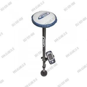
SPECTRA SP60
GNSS characteristics
■ 240 GNSS channels
- GPS L1C/A, L1P(Y), L2P(Y), L2C
- GLONASS L1C/A, L2C/A, L3
- BeiDou B1 (phase 2), B2
- Galileo E1, E5b
- QZSS L1C/A, L2C, L1SAIF
- SBAS L1C/A
- L-band
■ Support for Trimble RTXTM real-time
correction services
■ Patented Z-Blade technology for optimal
GNSS performance
- Full utilization of signals from all 6 GNSS
systems (GPS, GLONASS, BeiDou, Galileo,
QZSS and SBAS)
- Enhanced GNSS-centric algorithm:
fully-independent GNSS signal tracking
and optimal data processing, including
GPS-only, GLONASS-only or BeiDou-only
solution (autonomous to full RTK)
- Fast Search engine for quick acquisition
and re-acquisition of GNSS signals
■ Patented SBAS ranging for using SBAS code
& carrier observations and orbits in RTK
processing
■ Patented Strobe™ Correlator for reduced
GNSS multi-path
■ Up to 10 Hz real-time raw data (code & carrier
and position output)
■ Supported data formats: ATOM, CMR, CMR+,
RTCM 2.1, 2.3, 3.0, 3.1 and 3.2
(including MSM), CMRx and sCMRx
(rover only)
■ NMEA 0183 messages output
Real-Time accuracy (RMS) (1)(2)
SBAS (WAAS/EGNOS/MSAS/GAGAN)
■ Horizontal: < 50 cm
■ Vertical: < 85 cm
Real-Time DGPS position
■ Horizontal: 25 cm + 1 ppm
■ Vertical: 50 cm + 1 ppm
Real-Time Kinematic position (RTK)
■ Horizontal: 8 mm + 1 ppm
■ Vertical: 15 mm + 1 ppm
GIS accuracy modes
■ 30/30
- Horizontal: 30 cm
- Vertical: 30 cm
■ 7/2 (firmware option needed)
- Horizontal: 7 cm
- Vertical: 2 cm
Real-Time performance
■ Instant-RTK® Initialization
- Typically 2 sec for baselines < 20 km
- Up to 99.9% reliability
■ RTK initialization range: over 40 km
Post-Processing accuracy (RMS) (1)(2)
Static & Fast static
■ Horizontal: 3 mm + 0.5 ppm
■ Vertical: 5 mm + 0.5 ppm
High-Precision Static (3)
■ Horizontal: 3 mm + 0.1 ppm
■ Vertical: 3.5 mm + 0.4 ppm
Post-Processed Kinematic (PPK)
■ Horizontal: 8 mm + 1 ppm
■ Vertical: 15 mm + 1 ppm
Data logging characteristics
Recording interval
■ 0.1 - 999 seconds
Physical characteristics
Size
■ 21 x 21 x 7 cm (8.3 x 8.3 x 2.3 in)
Weight
■ 930 g (2.08 lb)
User interface
■ Five LEDs for Power, Tracking, Bluetooth,
Recording, Radio operations
I/O interface
■ RS232 serial link
■ USB 2.0/UART and USB OTG
■ Bluetooth 2.1 + EDR. Long range:
Class 1 (19dbm)
Memory
■ 256 MB internal memory NAND Flash
■ Over a month of 15 sec. raw GNSS data from
14 satellites
Operation
■ RTK rover & base
■ RTK network rover: VRS, FKP, MAC
■ NTRIP, Direct IP
■ Post-processing
■ Trimble RTX (satellite and cellular/IP)
Environmental characteristics
■ Operating temperature: -40° to +65°C /
(-40° to +149°F) (4)
■ Storage temperature: -40° to +85°C /
(-40° to +185°F) (5)
■ Humidity: 100% condensing
■ IP67 waterproof, sealed against sand and dust
■ Drop: 2m pole drop on concrete
■ Shocks: MIL STD 810
(fig 516.5-10) (01/2000)
■ Vibration : MIL-STD-810F
(fig 514.5C-17) (01/2000)
Power characteristics
■ Li-Ion battery, 7.4 V, 2600 mAh
■ Battery life:
10 hrs (GNSS On, UHF Rx Off)
8 hrs (GNSS On, UHF Rx On)
■ External DC power: 9-28 V
Standard system components
■ SP60 receiver
■ Li-Ion battery
■ Dual battery charger, power supply and
international power cord kit
■ Tape measure (3.6 m / 12 ft)
■ 7 cm pole extension
■ USB to mini-USB cable
■ 2 year warranty
Optional system components
■ SP60 UHF Kit (410-470 MHz 2W TRx)
■ SP60 Field Power Kit
■ SP60 Office Power Kit
■ Data collectors
- Ranger 3
- T41
- MobileMapper 50
- ProMark 120
- Nomad 1050
■ Field software
- Survey Mobile (Android)
- SPace control app for 3rd party
devices (Android)
- Survey Pro
- FAST Survey
- ProMark Field